Doc sheets on the two properties:
Regrid Links:
The two parcels are across the street from each other. One is 22 acres and one is 27 acres. They want $270k for the 27 acre property and $210k for the 27 acre one. That’s $480k at asking price for both of them.
They are owned by two different people, but my real estate agent says we can make a package for them both and should offer about $425k for the both of them and see where things land.
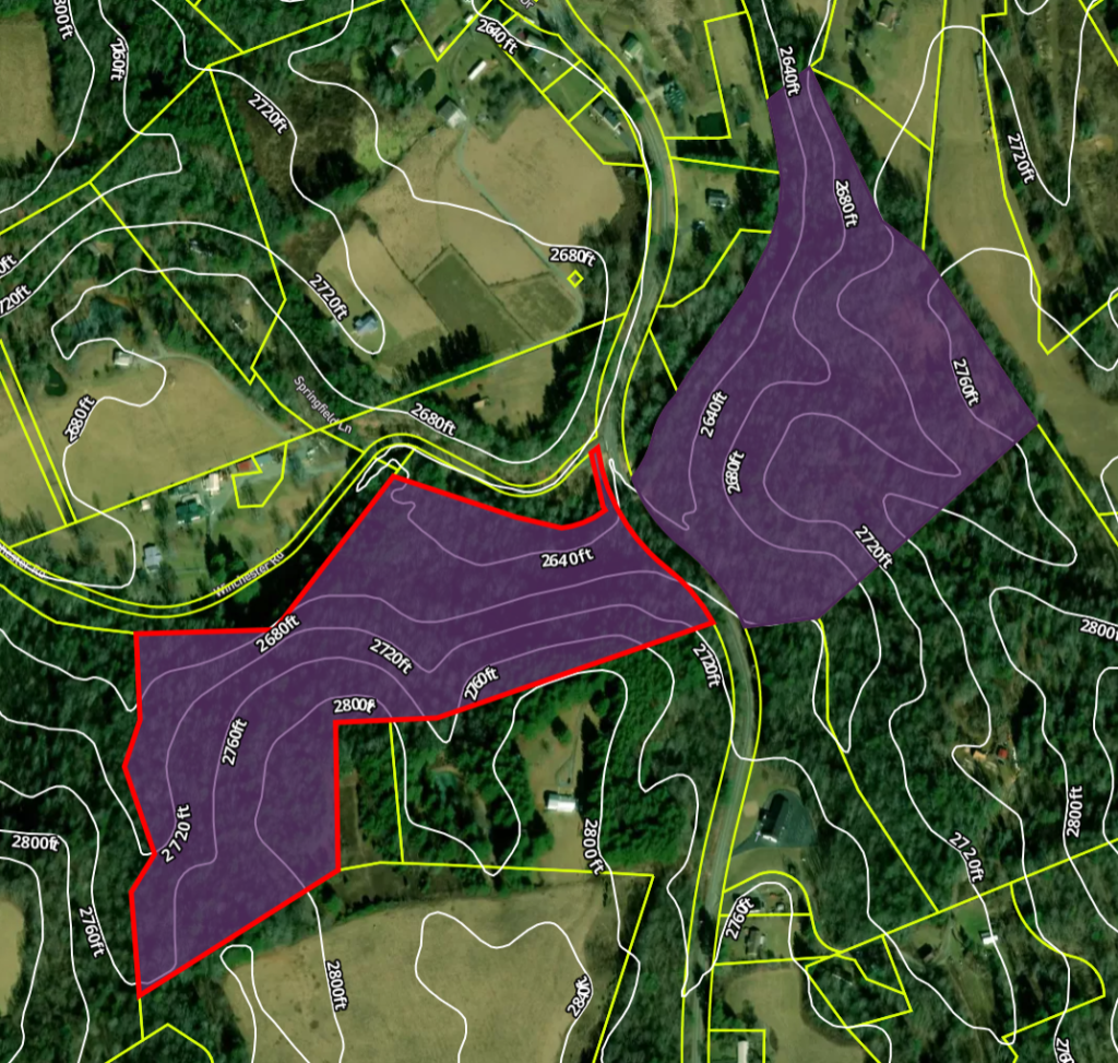
Topography is gently rolling, forested mountain terrain with elevation from 2640 ft. at Beaver Dam Creek, up to 2800 ft. across the whole 49 acres.
It is located in an unincorporated area called “Shady Valley” that has four ways into and out of the community. TN. Hwy 133 runs North / South through it, and US. Hwy 421 (Also known as Daniel Boone Trail, and “The Snake”) runs East / West. During a TEOTWAWKI event the whole valley could be blocked off from the rest of the world with four roadblocks.
22 minutes South of the Shady Valley intersection, on Hwy 133 is Mountain City Tn.; while 19 minutes North is Damascus Va.
Either locations are good for grocery shopping, but Damascus Va. sales tax is lower than that in Tennessee, since Tennessee has zero state income tax.
The closest Home Depot is in Bristol Va. which is 42 minutes away from the Shady Valley intersection of Hwy 133, and Hwy 421. There is also a Sam’s club and nicer grocery stores in Bristol, but those in Mountain City and Damascus are perfectly fine, albeit a bit dated.
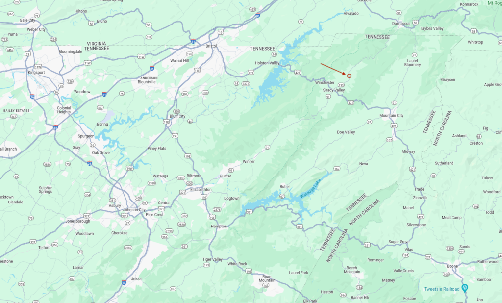
Here is a map showing the general location of the properties.
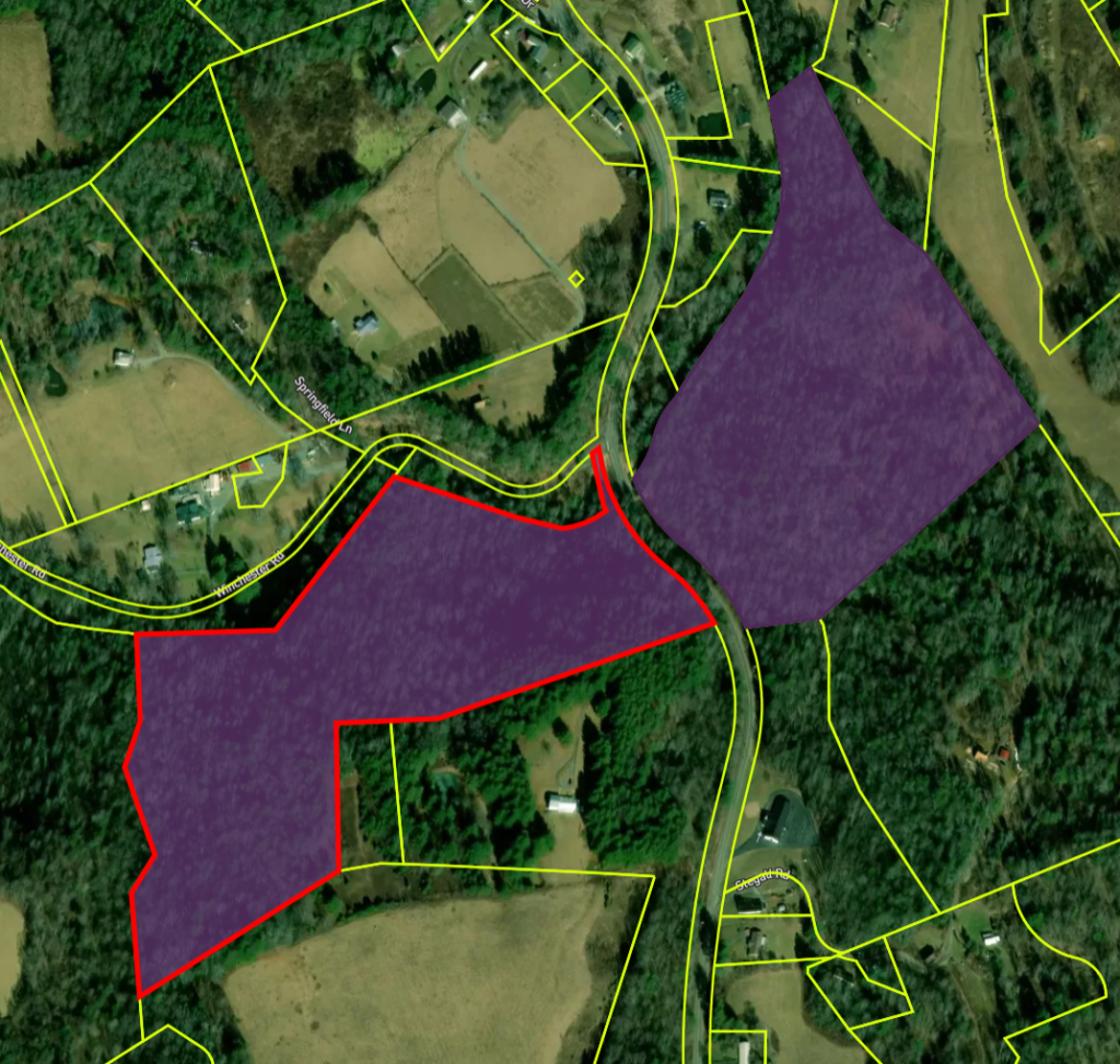
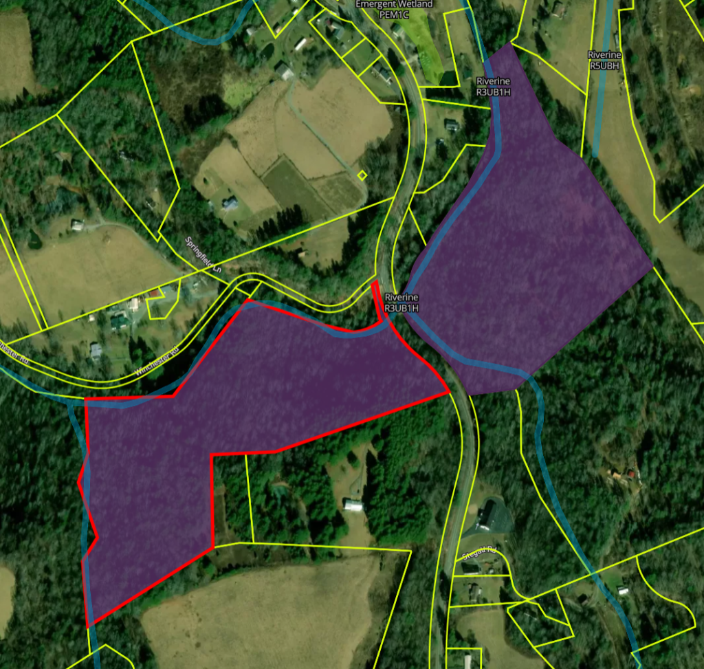
Here are the two properties. The one outlined in red is the 27 acre property. Highway 133 runs between them and Winchester Road turns off to the left just above them.
Here is the topography.
And here is the water. Grindstone Branch converges with Beaverdam Creek in between the properties.
The stream that runs across the top is Beaver Dam Creek. See a mention of it in this video.
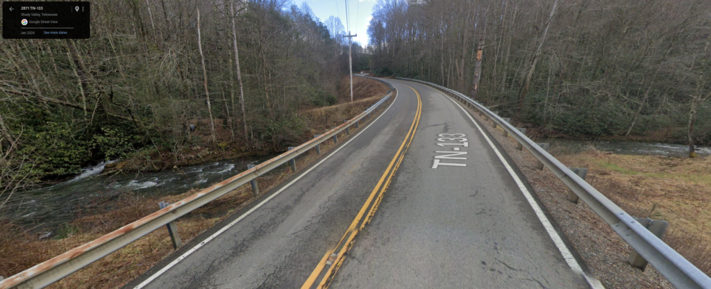
Here is a street view image of the properties. This is standing at the North end on Hwy 133, facing South. The 22 acre property is on the left and the 27 acre property is on the right. Beaver Dam Creek runs under the road in the foreground.
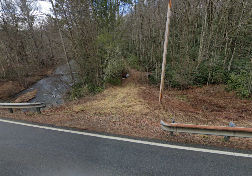
The break in the guard rail on the left is the driveway into the 22 acre property.
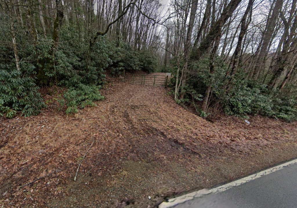
Just past the guardrail on the right is the driveway into the 27 acre property.
This is the driveway into the 22 acre property. The culverts running under the driveway carry Grindstone Branch into Beaverdam Creek.
This is the driveway into the 27 acre property.
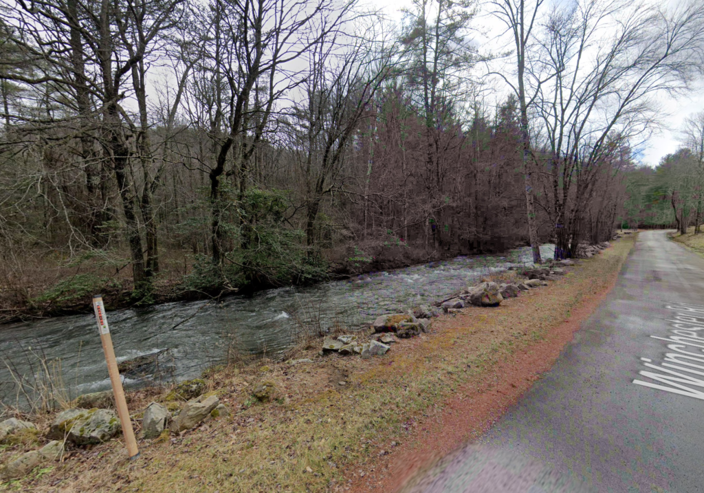
Here is a picture of the North edge of the 27 acre property (on the left of Winchester Road). There is a small slice of land between the creek and road that is roadway easement and some land that belongs to someone else. The edge of the property mostly runs down the middle of the creek, but the creek runs into and out of the 27 acre property as it goes along the edge.